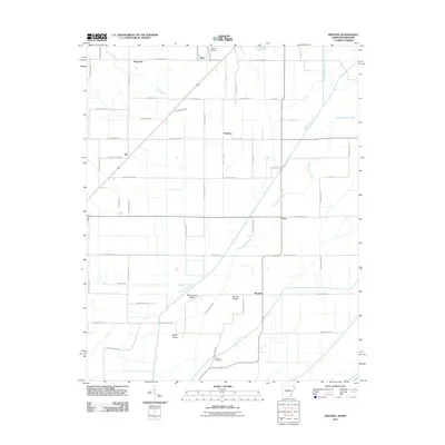
2011 Map of Mounds
USGS Topo · Published 2011About this map
The agricultural landscape of Greene County is defined by a complex network of drainage ditches and creeks designed to manage the fertile bottomlands of northeast Arkansas. Small rural communities and crossroads such as Mounds, Dixie, and Fritz dot the grid of county roads, showing the persistent settlement patterns of this region. The terrain is notably interrupted by distinct elevations like Horse Island Ridge, Brushy Ridge, and Poplar Ridge, which rise above the surrounding flats and historical floodplains. Water management is central to the area's geography, evidenced by the prominent Big Slough Ditch, Cottonwood Slough, and Mayo Ditch. For those researching local family history, Reddick Cemetery serves as a grounded landmark in the southern portion of the map. The presence of Rector Airport in the north and the diagonal transit route through Jay illustrates how modern infrastructure overlays the traditional farming tracts of the St. Francis River basin.
Find a feature on this map
63 named features on this map. Tap any name to fly to it.
Don’t see what you’re looking for? This feature index may not catch every label — zoom into the map to look around manually.
Map Details
Editions of this 2011 Mounds Map
This is the sole edition of this map. No revisions or reprints were ever made.
Other maps of this area

1934 · Kennett
USGS Topo · 1:62,500

1935 · Rector
USGS Topo · 1:62,500

1940 · Marmaduke
USGS Topo · 1:62,500

1940 · Kennett
USGS Topo · 1:62,500

1940 · Piggott
USGS Topo · 1:62,500

1956 · Kennett
USGS Topo · 1:62,500

1956 · Piggott
USGS Topo · 1:62,500

1957 · Poplar Bluff
USGS Topo · 1:250,000

1958 · Marmaduke
USGS Topo · 1:62,500

1958 · Rector
USGS Topo · 1:62,500