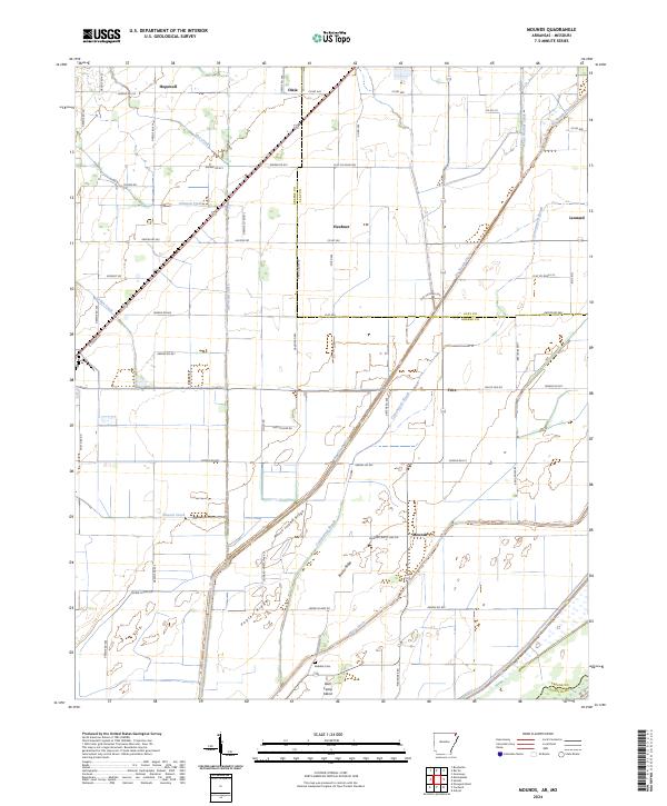
2024 Map of Mounds
USGS Topo · Published 2024About this map
Mounds sits at the heart of this agricultural landscape in Greene Co, Arkansas, where the terrain is defined by a sophisticated system of drainage and named topographic rises. The map reveals the extensive engineering of the wetlands, showing how Hurricane Ditch, Big Slough Ditch, and Mayo Ditch have been cut to manage water across the flatlands. Settlements such as Hopewell, Dixie, Heubner, and Fritz are linked by a dense grid of rural roads, including Greene Rd 801 and Allison Rd. Distinctive landforms such as Horse Island Ridge, Poplar Ridge, and Bark Camp Island provide subtle elevation in an otherwise level region. Genealogists and local historians will find the Reddick Cem near the southern boundary, a quiet landmark in this heavily channeled landscape on the border of Clay Co.
Find a feature on this map
71 named features on this map. Tap any name to fly to it.
Don’t see what you’re looking for? This feature index may not catch every label — zoom into the map to look around manually.
Map Details
Editions of this 2024 Mounds Map
This is the sole edition of this map. No revisions or reprints were ever made.
Other maps of this area

1934 · Kennett
USGS Topo · 1:62,500

1935 · Rector
USGS Topo · 1:62,500

1940 · Marmaduke
USGS Topo · 1:62,500

1940 · Kennett
USGS Topo · 1:62,500

1940 · Piggott
USGS Topo · 1:62,500

1956 · Kennett
USGS Topo · 1:62,500

1956 · Piggott
USGS Topo · 1:62,500

1957 · Poplar Bluff
USGS Topo · 1:250,000

1958 · Marmaduke
USGS Topo · 1:62,500

1958 · Rector
USGS Topo · 1:62,500