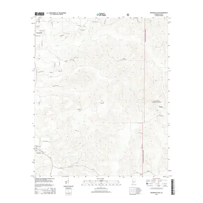
2014 Map of Moundville East
USGS Topo · Published 2014About this map
Moundville and Havana anchor the western edge of this landscape, where the flatlands of the Black Belt begin to give way to the more dissected terrain of the Talladega National Forest to the east. The area is defined by a dense network of family-associated cemeteries, such as Garthage Cem, Oak Hill Cem, and Lewis Cem, which serve as vital markers for local genealogical research. In the south, the settlement of Phipps sits near the forest boundary, connected to the larger community by China Grove Rd.
Find a feature on this map
52 named features on this map. Tap any name to fly to it.
Don’t see what you’re looking for? This feature index may not catch every label — zoom into the map to look around manually.
Map Details
Editions of this 2014 Moundville East Map
This is the sole edition of this map. No revisions or reprints were ever made.
Other maps of this area

1899 · Brookwood
USGS Topo · 1:125,000

1924 · Tuscaloosa
USGS Topo · 1:62,500

1926 · Tuscaloosa
USGS Topo · 1:62,500

1931 · Cottondale
USGS Topo · 1:48,000

1934 · Cottondale
USGS Topo · 1:62,500

1953 · Montgomery
USGS Topo · 1:250,000

1953 · Birmingham
USGS Topo · 1:250,000

1956 · Birmingham
USGS Topo · 1:250,000

1956 · Montgomery
USGS Topo · 1:250,000

1957 · Birmingham
USGS Topo · 1:250,000