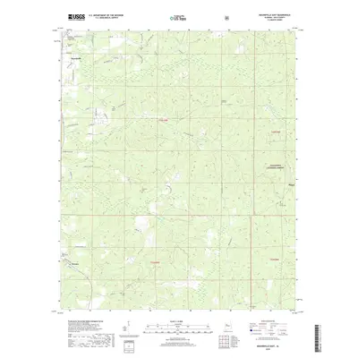
2018 Map of Moundville East
USGS Topo · Published 2018About this map
Moundville anchors the northwestern corner of this Hale County landscape, where the residential streets of Centerville St and Paige Blvd give way to a dense network of cemeteries and rural roads. The area is defined by its small community centers and burial grounds, such as the Carthage Presbyterian Church Cem and Oak Hill Church Cem, which serve as vital landmarks for local history. To the east, the terrain transitions into the protected woodlands of the Talladega National Forest, a significant topographical feature that shapes the eastern boundary of the map near Phipps.
Find a feature on this map
51 named features on this map. Tap any name to fly to it.
Don’t see what you’re looking for? This feature index may not catch every label — zoom into the map to look around manually.
Map Details
Editions of this 2018 Moundville East Map
This is the sole edition of this map. No revisions or reprints were ever made.
Other maps of this area

1899 · Brookwood
USGS Topo · 1:125,000

1924 · Tuscaloosa
USGS Topo · 1:62,500

1926 · Tuscaloosa
USGS Topo · 1:62,500

1931 · Cottondale
USGS Topo · 1:48,000

1934 · Cottondale
USGS Topo · 1:62,500

1953 · Montgomery
USGS Topo · 1:250,000

1953 · Birmingham
USGS Topo · 1:250,000

1956 · Birmingham
USGS Topo · 1:250,000

1956 · Montgomery
USGS Topo · 1:250,000

1957 · Birmingham
USGS Topo · 1:250,000