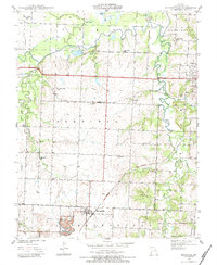
1939 Map of Moundville
USGS Topo · Published 1983About this map
Moundville serves as the primary hub in this southwestern Missouri landscape surveyed in the late 1930s. The region is defined by a dense network of rural infrastructure, featuring a notable concentration of country schools such as Hackberry Sch, Sylvan Dale Sch, and Nash Sch that anchored local farming communities. Transportation was dominated by the crossing paths of the Missouri Kansas Texas and the Missouri Pacific railroads, which facilitated the movement of goods and people through the plains.
Find a feature on this map
33 named features on this map. Tap any name to fly to it.
Don’t see what you’re looking for? This feature index may not catch every label — zoom into the map to look around manually.
Map Details
Editions of this 1939 Moundville Map
3 editions found

Other maps of this area

1884 · Fort Scott
USGS Topo · 1:125,000

1886 · Nevada
USGS Topo · 1:125,000

1886 · Fort Scott
USGS Topo · 1:125,000

1893 · Fort Scott
USGS Topo · 1:125,000

1894 · Nevada
USGS Topo · 1:125,000

1933 · Camp Clark
USGS Topo · 1:24,000

1938 · Metz
USGS Topo · 1:24,000

1938 · Horton
USGS Topo · 1:24,000

1939 · Metz
USGS Topo · 1:24,000

1939 · Horton
USGS Topo · 1:24,000