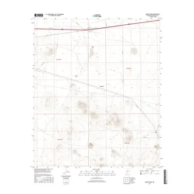
2017 Map of Mount Aden
USGS Topo · Published 2017About this map
The West Potrillo Mountains define the southern landscape of this New Mexico quadrangle, where volcanic landforms rise abruptly from the surrounding desert floor. Near the southeastern edge, the peaks of Mount Aden stand as a landmark for the small settlement of Aden, while the railroad siding at Chappel serves as a secondary point of activity further west. These locations are interconnected by a network of rural routes, including Co Rd B002 and Co Rd B004, which provide access through the arid terrain.
Find a feature on this map
23 named features on this map. Tap any name to fly to it.
Don’t see what you’re looking for? This feature index may not catch every label — zoom into the map to look around manually.
Map Details
Editions of this 2017 Mount Aden Map
This is the sole edition of this map. No revisions or reprints were ever made.
Other maps of this area

1941 · Aden
USGS Topo · 1:62,500

1943 · Aden
USGS Topo · 1:62,500

1943 · Corralitos Ranch
USGS Topo · 1:62,500

1955 · Las Cruces
USGS Topo · 1:250,000

1958 · Las Cruces
USGS Topo · 1:250,000

1972 · Cambray
USGS Topo · 1:24,000
1972 · X-7 Ranch
USGS Topo · 1:24,000

1972 · Lazy E Ranch
USGS Topo · 1:24,000
1982 · Deming
USGS Topo · 1:100,000
1985 · Magdalena Gap
USGS Topo · 1:24,000