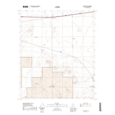
2023 Map of Mount Aden
USGS Topo · Published 2023About this map
Aden and Chappel sit within a high-desert landscape in Doña Ana County, where the southern reaches of New Mexico meet the volcanic terrain of the West Potrillo Mountains. The area is defined by its wide, open flats and strategic water catchments like Maries Tank and R R Tank, which historically supported ranching operations in this arid environment. Elevation rises sharply in the southeast at Aden Mountain, while the northern portion of the map is dominated by the broad expanse of White Flat and the drainage of Mason Draw.
Find a feature on this map
22 named features on this map. Tap any name to fly to it.
Don’t see what you’re looking for? This feature index may not catch every label — zoom into the map to look around manually.
Map Details
Editions of this 2023 Mount Aden Map
This is the sole edition of this map. No revisions or reprints were ever made.
Other maps of this area

1941 · Aden
USGS Topo · 1:62,500

1943 · Aden
USGS Topo · 1:62,500

1943 · Corralitos Ranch
USGS Topo · 1:62,500

1955 · Las Cruces
USGS Topo · 1:250,000

1958 · Las Cruces
USGS Topo · 1:250,000

1972 · Cambray
USGS Topo · 1:24,000
1972 · X-7 Ranch
USGS Topo · 1:24,000

1972 · Lazy E Ranch
USGS Topo · 1:24,000
1982 · Deming
USGS Topo · 1:100,000
1985 · Magdalena Gap
USGS Topo · 1:24,000