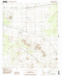
1996 Map of Mount Aden
USGS Topo · Published 2001About this map
The West Potrillo Mountains dominate the southern half of this landscape, rising above the surrounding Chihuahuan Desert terrain of Doña Ana County. This 1996 photoinspection reflects a sparsely populated area defined by volcanic features and cattle ranching, where isolated peaks like Mount Aden and the prominent Cinder Cone stand as landmarks. The presence of the Lazy E Ranch and X-7 Ranch highlights the ongoing pastoral use of the land, supported by water features such as Mauries Tank and the seasonal Muzzle Lake. Linear infrastructure, including a pipeline and power lines, cuts across the northern desert floor alongside Mason Draw. The small settlement at Aden and the railroad-related R R Tank indicate the vital transport corridor that skirted the northern edge of the volcanic field, connecting the remote hills to the broader regional economy.
Find a feature on this map
25 named features on this map. Tap any name to fly to it.
Don’t see what you’re looking for? This feature index may not catch every label — zoom into the map to look around manually.
Map Details
Editions of this 1996 Mount Aden Map
This is the sole edition of this map. No revisions or reprints were ever made.
Other maps of this area

1941 · Aden
USGS Topo · 1:62,500

1943 · Aden
USGS Topo · 1:62,500

1943 · Corralitos Ranch
USGS Topo · 1:62,500

1955 · Las Cruces
USGS Topo · 1:250,000

1958 · Las Cruces
USGS Topo · 1:250,000

1972 · Cambray
USGS Topo · 1:24,000
1972 · X-7 Ranch
USGS Topo · 1:24,000

1972 · Lazy E Ranch
USGS Topo · 1:24,000
1982 · Deming
USGS Topo · 1:100,000
1985 · Magdalena Gap
USGS Topo · 1:24,000