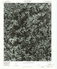
1976 Map of Mount Airy South
USGS Topo · Published 1979About this map
Mount Airy sits at the northern edge of this orthophoto study, surrounded by several smaller residential clusters that defined the local landscape in the mid-1970s. This aerial perspective, prepared by the Geological Survey in cooperation with the State of North Carolina, reveals the intricate patchwork of wooded hillsides and cleared agricultural land typical of the Surry County Piedmont. The Ararat River and its tributaries, including Stewarts Creek and Black Water Creek, carve deep drainage patterns through the terrain, dictating the placement of roads and homesteads. Local family and place-name landmarks like Boones Hill, Sheltontown, and Bannertown appear as distinct nodes of development along the primary transit corridors, while Toast marks the western fringe of the primary settlement area.
Find a feature on this map
8 named features on this map. Tap any name to fly to it.
Don’t see what you’re looking for? This feature index may not catch every label — zoom into the map to look around manually.
Map Details
Editions of this 1976 Mount Airy South Map
This is the sole edition of this map. No revisions or reprints were ever made.
Other maps of this area

1889 · Hillsville
USGS Topo · 1:125,000

1891 · Yadkinville
USGS Topo · 1:125,000

1892 · Hillsville
USGS Topo · 1:125,000

1893 · Yadkinville
USGS Topo · 1:125,000

1896 · Hillsville
USGS Topo · 1:125,000

1928 · Stuart
USGS Topo · 1:48,000

1931 · Stuart
USGS Topo · 1:62,500

1953 · Winston-Salem
USGS Topo · 1:250,000

1955 · Winston-Salem
USGS Topo · 1:250,000

1957 · Mount Airy
USGS Topo · 1:62,500