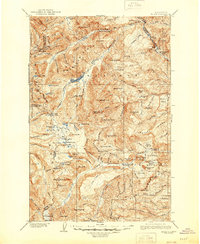
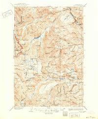
1904 Map of Mount Aix
USGS Topo · Published 1944About this map
Fife's Mine and the rugged reaches of the American Ridge dominate this early 20th-century survey of the Washington Cascades. The map records a landscape of high-elevation resource extraction and early mountain settlement, centered on the drainage of the Bumping River and the shores of Bumping Lake. Small outposts such as Lake House and Goose Prairie appear as isolated centers of activity, while the presence of Russell Ranch and Conrad Meadows reflects the seasonal grazing and homesteading patterns typical of the era. To the west, the boundary of Mt Rainier National Park borders a terrain defined by named peaks like Mount Aix and Bismarck Peak. The network of trails following the Tieton River and crossing over Cowlitz Pass illustrates the primary transportation corridors used before modern road development reshaped access to the Yakima County interior.
Find a feature on this map
124 named features on this map. Tap any name to fly to it.
Don’t see what you’re looking for? This feature index may not catch every label — zoom into the map to look around manually.
Map Details
Editions of this 1904 Mount Aix Map
6 editions found
Other maps of this area

1897 · Mount Stuart
USGS Topo · 1:125,000

1899 · Ellensburg
USGS Topo · 1:125,000

1901 · Ellensburg
USGS Topo · 1:125,000

1901 · Snoqualmie Pass
USGS Topo · 1:125,000

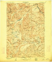
1902 · Mount Aix
USGS Topo · 1:125,000

1902 · Mount Stuart
USGS Topo · 1:125,000

1903 · Snoqualmie
USGS Topo · 1:125,000

1904 · Mt Aix
USGS Topo · 1:125,000

1904 · Mount Adams
USGS Topo · 1:125,000

1907 · Mount Adams
USGS Topo · 1:125,000