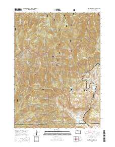
2014 Map of Mount Ashland
USGS Topo · Published 2014About this map
Mount Ashland dominates this section of the Siskiyou Mountains, where the high-altitude terrain marks the state line at the Oregon and California border. This survey documents a landscape defined by industrial and recreational transit, with the Pacific Crest National Scenic Trail winding through the Rogue River National Forest and Klamath National Forest. In the southern reaches, the small settlements of Colestin and Cole sit near the headwaters of Cottonwood Cr, illustrating the long-standing importance of these mountain passes for movement between the Rogue and Shasta valleys. The map records several notable plateaus and drainage features, including Mudusa Flat, Virgin Flat, and the cascading Chocolate Falls. The network of forest development roads, such as the Mount Ashland Ski Rd, highlights the area's development for both timber management and winter sports.
Find a feature on this map
97 named features on this map. Tap any name to fly to it.
Don’t see what you’re looking for? This feature index may not catch every label — zoom into the map to look around manually.
Map Details
Editions of this 2014 Mount Ashland Map
This is the sole edition of this map. No revisions or reprints were ever made.
Other maps of this area

1886 · Shasta
USGS Topo · 1:250,000

1891 · Ashland
USGS Topo · 1:250,000

1893 · Ashland
USGS Topo · 1:250,000

1894 · Shasta
USGS Topo · 1:250,000

1897 · Ashland
USGS Topo · 1:250,000

1932 · Yreka
USGS Topo · 1:96,000

1938 · Medford
USGS Topo · 1:125,000

1939 · Yreka
USGS Topo · 1:125,000

1948 · Weed
USGS Topo · 1:250,000

1950 · Weed
USGS Topo · 1:250,000