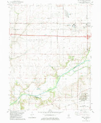
1982 Map of Mount Auburn
USGS Topo · Published 1983About this map
The Sangamon River meanders through the central Illinois prairie, marking the historical boundary between Mechanicsburg and Mount Auburn. This early 1980s landscape reveals a region transitioning between traditional agriculture and industrial extraction, most notably at the Mt Auburn Consolidated Oil Field and the Roby East Field. The distribution of infrastructure highlights the area's role as a transit corridor, with the Norfolk and Western and Baltimore and Ohio railroads cutting through the territory. Genealogists will find significant value in the numerous burial sites across the quadrangle, including the Sangamon County Home Cem, Bethel Cem, and Milligan Cem. The presence of Industrial Waste Ponds near Illiopolis and various Oil Wells across Blind Horse Ridge reflects the late 20th-century economic activity that defined this portion of Christian and Sangamon counties.
Find a feature on this map
37 named features on this map. Tap any name to fly to it.
Don’t see what you’re looking for? This feature index may not catch every label — zoom into the map to look around manually.
Map Details
Editions of this 1982 Mount Auburn Map
This is the sole edition of this map. No revisions or reprints were ever made.
Other maps of this area

1923 · Taylorville
USGS Topo · 1:62,500

1925 · Taylorville
USGS Topo · 1:62,500

1952 · Assumption
USGS Topo · 1:62,500

1954 · Niantic
USGS Topo · 1:62,500

1954 · Mechanicsburg
USGS Topo · 1:62,500

1958 · Decatur
USGS Topo · 1:250,000

1961 · Decatur
USGS Topo · 1:250,000
1982 · Mechanicsburg
USGS Topo · 1:24,000
1982 · Stonington
USGS Topo · 1:24,000
1982 · Lake Fork
USGS Topo · 1:24,000