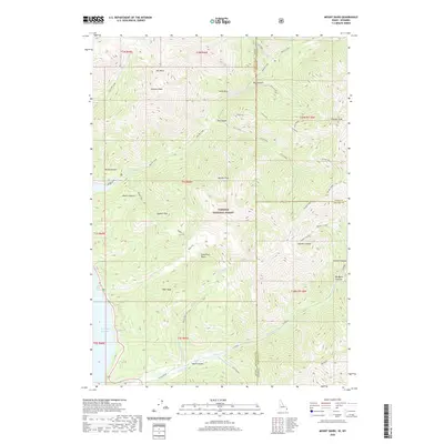
2020 Map of Mount Baird
USGS Topo · Published 2020About this map
Mt Baird and Elkhorn Peak anchor a high-altitude landscape within the Targhee National Forest along the Idaho-Wyoming border. This 2020 survey documents a complex network of high basins and steep canyons, where the hydrology shifts from the high headwaters of Little Elk Creek and Big Elk Creek down toward the eastern edge of the Palisades Reservoir. The terrain is defined by dramatic elevation changes, notably at Hells Hole and the narrow passage of Box Canyon.
Find a feature on this map
47 named features on this map. Tap any name to fly to it.
Don’t see what you’re looking for? This feature index may not catch every label — zoom into the map to look around manually.
Map Details
Editions of this 2020 Mount Baird Map
This is the sole edition of this map. No revisions or reprints were ever made.
Other maps of this area

1931 · Jackson
USGS Topo · 1:125,000

1932 · Irwin
USGS Topo · 1:96,000

1935 · Irwin
USGS Topo · 1:125,000

1935 · Jackson
USGS Topo · 1:125,000

1955 · Driggs
USGS Topo · 1:250,000

1958 · Driggs
USGS Topo · 1:250,000

1962 · Driggs
USGS Topo · 1:250,000

1963 · Teton Pass
USGS Topo · 1:24,000

1963 · Observation Peak
USGS Topo · 1:24,000

1963 · Ferry Peak
USGS Topo · 1:24,000