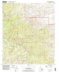
1996 Map of Mount Bigelow
USGS Topo · Published 2002About this map
The high peaks of the Santa Catalina Mountains dominate this 1996 survey, revealing a landscape defined by dramatic elevation changes and a legacy of mineral extraction. Along Oracle Ridge and the northern slopes, numerous historic workings such as the Geesaman Mine Group, Daily Mine Group, and Leatherwood Mine Group indicate the intensive copper and silver prospecting that once characterized the area. These mines are concentrated near Lombar Hill and Marble Peak, where the geological contact zones drew early miners.
Find a feature on this map
83 named features on this map. Tap any name to fly to it.
Don’t see what you’re looking for? This feature index may not catch every label — zoom into the map to look around manually.
Map Details
Editions of this 1996 Mount Bigelow Map
This is the sole edition of this map. No revisions or reprints were ever made.
Other maps of this area

1904 · Tucson
USGS Topo · 1:125,000

1905 · Tucson
USGS Topo · 1:125,000

1911 · Winkelman
USGS Topo · 1:125,000

1913 · Winkelman
USGS Topo · 1:125,000

1948 · Mammoth
USGS Topo · 1:62,500

1948 · Campo Bonito
USGS Topo · 1:24,000

1948 · Peppersauce Wash
USGS Topo · 1:24,000

1949 · Campo Bonito
USGS Topo · 1:24,000
1949 · Peppersauce Wash
USGS Topo · 1:24,000
1951 · Mammoth
USGS Topo · 1:62,500