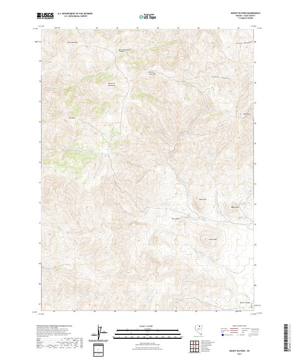
2021 Map of Mount Blitzen
USGS Topo · Published 2021About this map
The Tuscarora Mountains dominate this high-elevation landscape in Elko County, where multiple peaks and drainages define a complex topographical network. Significant summits include Mt Neva, McCann Creek Mtn, and the namesake Mt Blitzen in the northeast. This 2021 survey illustrates the intricate watershed systems typical of the Great Basin, where seasonal watercourses such as Rock Cr, Toe Jam Cr, and Rattlesnake Cr carve deep paths through the high country. Historical land divisions are marked by the township and range lines of t40n r50e, t40n r51e, t39n r50e, and t39n r51e, reflecting the systematic surveying of Nevada's public lands. Distinctive landforms like Beard Hill, Castile Mtn, and Battle Mtn sit amidst several named canyons, including Sixmile Canyon and Big Cottonwood Canyon, providing a clear record of the region's diverse relief.
Find a feature on this map
26 named features on this map. Tap any name to fly to it.
Don’t see what you’re looking for? This feature index may not catch every label — zoom into the map to look around manually.
Map Details
Editions of this 2021 Mount Blitzen Map
This is the sole edition of this map. No revisions or reprints were ever made.
Other maps of this area

1955 · McDermitt
USGS Topo · 1:250,000

1956 · Tuscarora
USGS Topo · 1:62,500

1956 · Mt. Blitzen
USGS Topo · 1:62,500

1959 · McDermitt
USGS Topo · 1:250,000

1970 · Sugarloaf Butte
USGS Topo · 1:24,000

1970 · Lake Mountain
USGS Topo · 1:24,000
1970 · China Camp
USGS Topo · 1:24,000
1972 · Lake Mountain
USGS Topo · 1:24,000

1982 · Tuscarora
USGS Topo · 1:100,000
1987 · Cottonwood Peak
USGS Topo · 1:24,000