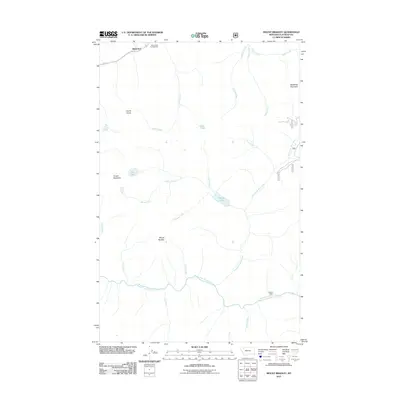
2011 Map of Mount Bradley
USGS Topo · Published 2011About this map
Singleshot sits near the northern boundary of this Flathead County landscape, where the Middle Fork Flathead River carves through the southern terrain. This high-altitude region is defined by a dense network of mountain drainage systems, including Twentyfive Mile Creek, Giefer Creek, and Moose Creek, which flow between prominent peaks such as Mount Bradley and Baldhead Mountain. Evidence of seasonal habitation and recreation appears at the Granite Cabin and the Devil Creek Campground along the northern road corridor.
Find a feature on this map
26 named features on this map. Tap any name to fly to it.
Don’t see what you’re looking for? This feature index may not catch every label — zoom into the map to look around manually.
Map Details
Editions of this 2011 Mount Bradley Map
This is the sole edition of this map. No revisions or reprints were ever made.
Other maps of this area

1913 · Marias Pass
USGS Topo · 1:125,000

1914 · Nyack
USGS Topo · 1:125,000

1958 · Red Plume Mountain
USGS Topo · 1:24,000

1958 · Capitol Mountain
USGS Topo · 1:24,000

1958 · Circus Peak
USGS Topo · 1:24,000

1958 · Nimrod
USGS Topo · 1:24,000

1958 · Mount Bradley
USGS Topo · 1:24,000

1958 · Horseshoe Peak
USGS Topo · 1:24,000

1960 · Cut Bank
USGS Topo · 1:250,000

1963 · Cut Bank
USGS Topo · 1:250,000