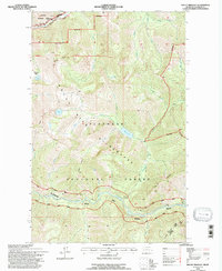
1994 Map of Mount Bradley
USGS Topo · Published 1997About this map
Flathead River Middle Fork serves as a critical corridor through this mountain landscape, its designation as a Scenic River highlighting the preserved character of the region in the 1990s. The terrain is defined by high-altitude features like Mount Bradley and the Devils Hump, situated at the convergence of several major land management boundaries. This era shows the heavy reliance on natural water systems, with drainage networks including Twentyfive Mile Creek, Moose Creek, and Coal Creek feeding into the river system.
Find a feature on this map
35 named features on this map. Tap any name to fly to it.
Don’t see what you’re looking for? This feature index may not catch every label — zoom into the map to look around manually.
Map Details
Editions of this 1994 Mount Bradley Map
This is the sole edition of this map. No revisions or reprints were ever made.
Other maps of this area

1913 · Marias Pass
USGS Topo · 1:125,000

1914 · Nyack
USGS Topo · 1:125,000

1958 · Red Plume Mountain
USGS Topo · 1:24,000

1958 · Capitol Mountain
USGS Topo · 1:24,000

1958 · Circus Peak
USGS Topo · 1:24,000

1958 · Nimrod
USGS Topo · 1:24,000

1958 · Mount Bradley
USGS Topo · 1:24,000

1958 · Horseshoe Peak
USGS Topo · 1:24,000

1960 · Cut Bank
USGS Topo · 1:250,000

1963 · Cut Bank
USGS Topo · 1:250,000