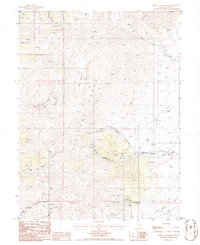
1986 Map of Mount Callaghan
USGS Topo · Published 1986About this map
The high ridges of the Toiyabe Range dominate this mid-1980s landscape in Lander County, anchored by the prominent summit of Mount Callaghan. The map records a rugged environment shaped by water and mineral exploration, with numerous prospects and prospect pits scattered across the steep drainages of Charlie Canyon and Callaghan Canyon. Human activity is concentrated along the lower elevations where the Callaghan Ranch sits near the confluence of local forks. Water sources are critical identifiers here, from the headwaters of Boone Creek and Skull Creek to the seasonal flow of Cottonwood Spr and Ox Corral Creek. A notable Pipeline and a network of unimproved roads suggest the ongoing utility of this high-desert terrain for ranching and resource surveying during the late twentieth century.
Find a feature on this map
18 named features on this map. Tap any name to fly to it.
Don’t see what you’re looking for? This feature index may not catch every label — zoom into the map to look around manually.
Map Details
Editions of this 1986 Mount Callaghan Map
This is the sole edition of this map. No revisions or reprints were ever made.
Other maps of this area

1926 · Roberts Mountains
USGS Topo · 1:250,000

1929 · Roberts Mountains
USGS Topo · 1:250,000

1955 · Millett
USGS Topo · 1:250,000

1956 · Mount Callaghan
USGS Topo · 1:62,500

1956 · Hall Creek
USGS Topo · 1:62,500

1959 · Millett
USGS Topo · 1:250,000

1969 · Joe Eason Mtn
USGS Topo · 1:24,000

1969 · Yankee Blade
USGS Topo · 1:24,000

1969 · Vigus Butte NE
USGS Topo · 1:24,000

1979 · Simpson Park Mtns
USGS Topo · 1:100,000