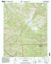
1995 Map of Mount Carmel
USGS Topo · Published 2000About this map
San Francisquito Grant and El Potrero De San Carlos Grant dominate the northern landscape of this Monterey County survey, reflecting the enduring legacy of Spanish and Mexican land grants in California. The terrain rises sharply toward the south into the Los Padres National Forest, where the Ventana Wilderness protects the high peaks and steep canyons. Significant summits like Mount Carmel and Pinyon Peak, featuring the Sid Ormsbee Lookout, overlook a complex network of drainages including San Jose Creek, Las Garzas Creek, and Garrapata Creek.
Find a feature on this map
48 named features on this map. Tap any name to fly to it.
Don’t see what you’re looking for? This feature index may not catch every label — zoom into the map to look around manually.
Map Details
Editions of this 1995 Mount Carmel Map
This is the sole edition of this map. No revisions or reprints were ever made.
Other maps of this area

1910 · Salinas
USGS Topo · 1:31,680

1912 · Salinas
USGS Topo · 1:62,500

1913 · Monterey
USGS Topo · 1:62,500

1918 · Point Sur
USGS Topo · 1:62,500

1920 · Jamesburg
USGS Topo · 1:48,000

1921 · Jamesburg
USGS Topo · 1:62,500

1925 · Point Sur
USGS Topo · 1:62,500

1939 · Jamesburg
USGS Topo · 1:62,500

1940 · Salinas
USGS Topo · 1:62,500

1940 · Jamesburg
USGS Topo · 1:62,500