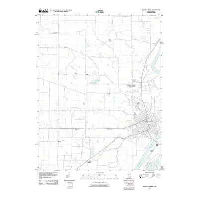
2010 Map of Mount Carmel
USGS Topo · Published 2010About this map
Mount Carmel serves as the focal point of this study, positioned near the confluence where the White River meets the Wabash River. This riverine landscape is defined by its extensive collection of memorial sites, including the large Highland Memorial Cemetery and several smaller family plots such as the Woods Family Cemetery and the Beauchamp and Harper Cemetery. The rural character of the surrounding Wabash County countryside is marked by small settlements and historic transit points like Schrodts Station, Maud, and Odgen, which are connected by a grid of numbered boulevards and county roads.
Find a feature on this map
66 named features on this map. Tap any name to fly to it.
Don’t see what you’re looking for? This feature index may not catch every label — zoom into the map to look around manually.
Map Details
Editions of this 2010 Mount Carmel Map
This is the sole edition of this map. No revisions or reprints were ever made.
Other maps of this area

1901 · Princeton
USGS Topo · 1:62,500

1903 · Princeton
USGS Topo · 1:62,500

1903 · Patoka
USGS Topo · 1:125,000

1904 · Mount Carmel
USGS Topo · 1:62,500

1911 · Sumner
USGS Topo · 1:62,500

1913 · Sumner
USGS Topo · 1:62,500

1915 · Vincennes
USGS Topo · 1:62,500

1944 · Vincennes
USGS Topo · 1:62,500

1956 · Vincennes
USGS Topo · 1:250,000

1957 · Vincennes
USGS Topo · 1:250,000