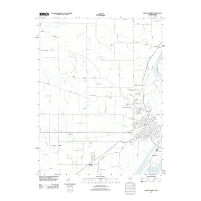
2012 Map of Mount Carmel
USGS Topo · Published 2012About this map
The Wabash River and White River converge at the southeastern corner of this Illinois-Indiana border region, where Patoka Island and Burnet Pond mark the low-lying fluvial landscape. The urban center of Mount Carmel is documented in detail, showing the campus of Wabash Valley College and a dense network of local streets. Outside the city, the landscape is defined by agricultural lands and small settlements like Maud, Patton, and Schrodts Station.
Find a feature on this map
127 named features on this map. Tap any name to fly to it.
Don’t see what you’re looking for? This feature index may not catch every label — zoom into the map to look around manually.
Map Details
Editions of this 2012 Mount Carmel Map
This is the sole edition of this map. No revisions or reprints were ever made.
Other maps of this area

1901 · Princeton
USGS Topo · 1:62,500

1903 · Princeton
USGS Topo · 1:62,500

1903 · Patoka
USGS Topo · 1:125,000

1904 · Mount Carmel
USGS Topo · 1:62,500

1911 · Sumner
USGS Topo · 1:62,500

1913 · Sumner
USGS Topo · 1:62,500

1915 · Vincennes
USGS Topo · 1:62,500

1944 · Vincennes
USGS Topo · 1:62,500

1956 · Vincennes
USGS Topo · 1:250,000

1957 · Vincennes
USGS Topo · 1:250,000