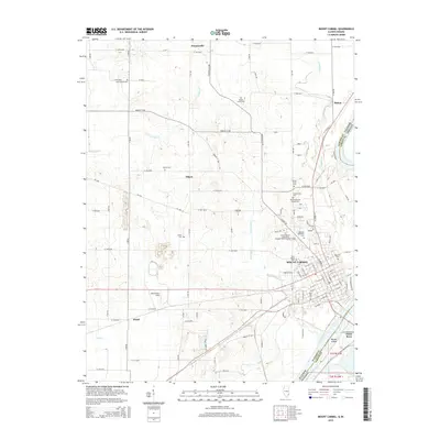
2015 Map of Mount Carmel
USGS Topo · Published 2015About this map
Mount Carmel sits at the strategic confluence of the Wabash River and the White River, a location long defined by the movement of goods and people across the Illinois-Indiana border. The 2015 landscape shows a developed educational and civic center, anchored by the Illinois Eastern Community Colleges-Wabash Valley College and several large memorial grounds including Highland Memorial Cem and Rose Hill Cem. Further west, the rail corridor utilized by the Norfolk Southern cuts through the river valley near Beckerman Field.
Find a feature on this map
118 named features on this map. Tap any name to fly to it.
Don’t see what you’re looking for? This feature index may not catch every label — zoom into the map to look around manually.
Map Details
Editions of this 2015 Mount Carmel Map
This is the sole edition of this map. No revisions or reprints were ever made.
Other maps of this area

1901 · Princeton
USGS Topo · 1:62,500

1903 · Princeton
USGS Topo · 1:62,500

1903 · Patoka
USGS Topo · 1:125,000

1904 · Mount Carmel
USGS Topo · 1:62,500

1911 · Sumner
USGS Topo · 1:62,500

1913 · Sumner
USGS Topo · 1:62,500

1915 · Vincennes
USGS Topo · 1:62,500

1944 · Vincennes
USGS Topo · 1:62,500

1956 · Vincennes
USGS Topo · 1:250,000

1957 · Vincennes
USGS Topo · 1:250,000