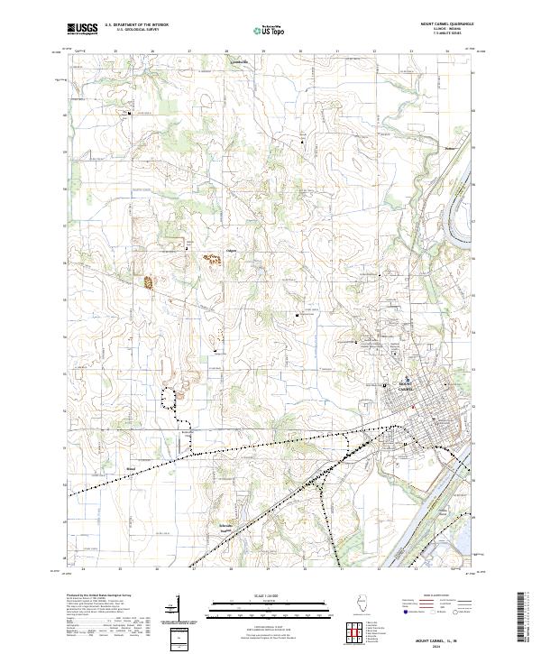
2024 Map of Mount Carmel
USGS Topo · Published 2024About this map
The Wabash River forms a wide natural boundary between Illinois and Indiana, anchoring the city of Mount Carmel at its eastern edge. This modern survey illustrates the dense residential grid of the city, centered around the Wabash County Courthouse, and extends to the outlying agricultural regions of Friendsville, Maud, and Patton. The landscape is a mix of fertile river bottomlands and developed uplands, where the Wabash Valley College campus sits near the Highland Memorial Cemetery. The transportation network is defined by the Norfolk Southern railway cutting through the southern landscape near Schrodts Station. Numerous family and community cemeteries, such as Nye Chapel Cem, Hallock Cem, and Rose Hill Cem, are scattered across the quadrangle, serving as vital landmarks for those tracing the lineage of Wabash County families.
Find a feature on this map
84 named features on this map. Tap any name to fly to it.
Don’t see what you’re looking for? This feature index may not catch every label — zoom into the map to look around manually.
Map Details
Editions of this 2024 Mount Carmel Map
This is the sole edition of this map. No revisions or reprints were ever made.
Other maps of this area

1901 · Princeton
USGS Topo · 1:62,500

1903 · Princeton
USGS Topo · 1:62,500

1903 · Patoka
USGS Topo · 1:125,000

1904 · Mount Carmel
USGS Topo · 1:62,500

1911 · Sumner
USGS Topo · 1:62,500

1913 · Sumner
USGS Topo · 1:62,500

1915 · Vincennes
USGS Topo · 1:62,500

1944 · Vincennes
USGS Topo · 1:62,500

1956 · Vincennes
USGS Topo · 1:250,000

1957 · Vincennes
USGS Topo · 1:250,000