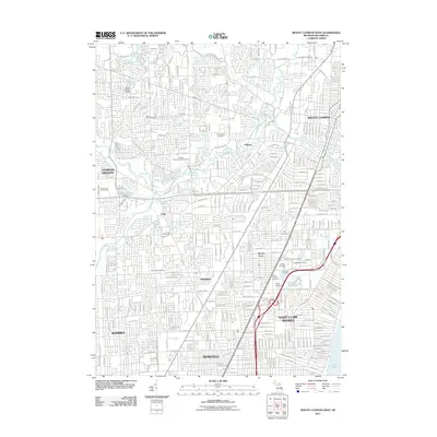
2011 Map of Mount Clemens West
USGS Topo · Published 2011About this map
The Clinton River and its numerous tributaries, such as the Middle Branch Clinton River and North Branch Clinton River, define the landscape as it winds through this densely developed portion of Macomb County. This 2011 survey reveals a complex grid of residential expansion and critical drainage infrastructure, including the Kukuk Drain, Stadler Drain, and Hildebrandt Drain. For genealogists and local historians, the sheet is exceptionally rich in burial sites, documenting numerous cultural and religious communities at Hebrew Memorial Park, the Russian Orthodox Cemetery, and Brith Sholom Cemetery. The map covers the convergence of several major municipalities, from the established neighborhoods of Mount Clemens and Fraser to the southeastern edge bordering Lake St Clair in Saint Clair Shores, showing how the modern suburban footprint has integrated with the natural waterways of the region.
Find a feature on this map
146 named features on this map. Tap any name to fly to it.
Don’t see what you’re looking for? This feature index may not catch every label — zoom into the map to look around manually.
Map Details
Editions of this 2011 Mount Clemens West Map
This is the sole edition of this map. No revisions or reprints were ever made.
Other maps of this area

1905 · Detroit
USGS Topo · 1:62,500

1905 · Grosse Pointe
USGS Topo · 1:62,500

1908 · Rochester
USGS Topo · 1:62,500

1912 · Mt Clemens
USGS Topo · 1:62,500

1918 · Detroit
USGS Topo · 1:62,500

1918 · Grosse Pointe
USGS Topo · 1:62,500

1924 · Detroit
USGS Topo · 1:62,500

1929 · Mt Clemens
USGS Topo · 1:62,500

1934 · Detroit
USGS Topo · 1:62,500

1936 · Warren
USGS Topo · 1:31,680