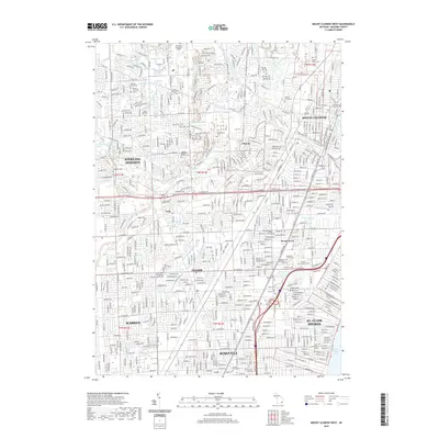
2019 Map of Mount Clemens West
USGS Topo · Published 2019About this map
The Clinton River and its intricate network of drains, including the Utica Drain and Kukuk Drain, define the hydrologic character of this Macomb County landscape. This 2019 survey documents a densely suburbanized region where modern development intersects with numerous legacy burial grounds. The concentrated presence of sites like the Russian Orthodox Cem, Saint John's Evangelical Lutheran Church Cem, and the Workmen Circle Cem provides significant data for genealogical research within the diverse ethnic and religious communities of Sterling Heights and Mount Clemens. In the central portion of the map, the settlement of Cady and Cady's Corners Cem mark a historical node amidst the contemporary expansion. Large institutional footprints such as Macomb Community College and Baker College of Clinton Township signify the area's role as a regional educational hub.
Find a feature on this map
283 named features on this map. Tap any name to fly to it.
Don’t see what you’re looking for? This feature index may not catch every label — zoom into the map to look around manually.
Map Details
Editions of this 2019 Mount Clemens West Map
This is the sole edition of this map. No revisions or reprints were ever made.
Other maps of this area

1905 · Detroit
USGS Topo · 1:62,500

1905 · Grosse Pointe
USGS Topo · 1:62,500

1908 · Rochester
USGS Topo · 1:62,500

1912 · Mt Clemens
USGS Topo · 1:62,500

1918 · Detroit
USGS Topo · 1:62,500

1918 · Grosse Pointe
USGS Topo · 1:62,500

1924 · Detroit
USGS Topo · 1:62,500

1929 · Mt Clemens
USGS Topo · 1:62,500

1934 · Detroit
USGS Topo · 1:62,500

1936 · Warren
USGS Topo · 1:31,680