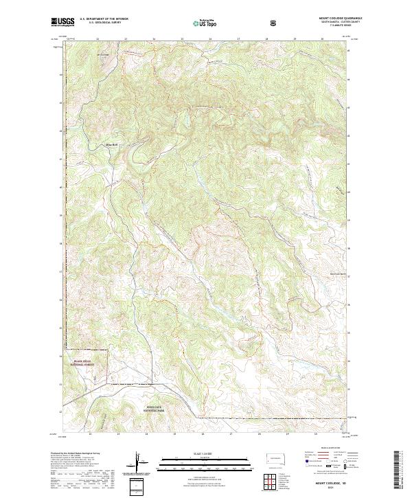
2021 Map of Mount Coolidge
USGS Topo · Published 2021About this map
Mt Coolidge rises as a prominent landmark in this section of Custer County, situated within the expansive Black Hills National Forest. The landscape is defined by its network of drainages including French Creek, Flynn Creek, and South Fork Lame Johnny Creek, which carve through deep features like Gordon Canyon and Red Canyon. The small settlement at Blue Bell serves as a human waypoint in a region primarily dedicated to conservation and recreation. To the south, the boundary of Wind Cave National Park is visible near Rankin Ridge, illustrating the transition between different managed wilderness areas. This map reveals a complex infrastructure of trails and backcountry routes, such as the Big Tree and Robbers Roost Draw Trail, that have historically provided access to the high ridges and secluded canyons of the Black Hills.
Find a feature on this map
46 named features on this map. Tap any name to fly to it.
Don’t see what you’re looking for? This feature index may not catch every label — zoom into the map to look around manually.
Map Details
Editions of this 2021 Mount Coolidge Map
This is the sole edition of this map. No revisions or reprints were ever made.
Other maps of this area

1894 · Hermosa
USGS Topo · 1:125,000

1896 · Harney Peak
USGS Topo · 1:125,000

1901 · Hermosa
USGS Topo · 1:125,000

1901 · Harney Peak
USGS Topo · 1:125,000

1954 · Iron Mountain
USGS Topo · 1:24,000

1954 · Custer
USGS Topo · 1:24,000

1954 · Hayward
USGS Topo · 1:24,000

1954 · Mount Rushmore
USGS Topo · 1:62,500

1955 · Mt. Coolidge
USGS Topo · 1:24,000
1955 · Cicero Peak
USGS Topo · 1:24,000