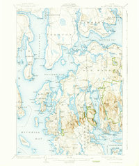
1904 Map of Mount Desert
USGS Topo · Published 1938About this map
Acadia National Park and the rugged coastal reaches of Mount Desert Island are shown here just after the turn of the century. The map illustrates a landscape of maritime trade and early tourism, featuring established coastal settlements like Southwest Harbor and Lamoine Beach alongside inland villages such as Town Hill and West Eden. Scientific activity is evidenced by the Biological Laboratory near Salsbury Cove, while the topographic detail traces the elevation of prominent peaks like St Sauveur Mt. and Acadia Mt..
Find a feature on this map
220 named features on this map. Tap any name to fly to it.
Don’t see what you’re looking for? This feature index may not catch every label — zoom into the map to look around manually.
Map Details
Editions of this 1904 Mount Desert Map
5 editions found
Other maps of this area

1900 · Orland
USGS Topo · 1:62,500

1904 · Deer Isle
USGS Topo · 1:62,500

1904 · Mount Desert
USGS Topo · 1:62,500

1904 · Swan Island
USGS Topo · 1:62,500

1904 · Bar Harbor
USGS Topo · 1:62,500

1904 · Bluehill
USGS Topo · 1:62,500

1905 · Penobscot Bay
USGS Topo · 1:125,000

1911 · Ellsworth
USGS Topo · 1:62,500

1930 · Tunk Lake
USGS Topo · 1:48,000

1932 · Tunk Lake
USGS Topo · 1:62,500