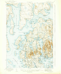
1942 Map of Mount Desert
USGS Topo · Published 1942About this map
Union River Bay and Western Bay define the coastal character of this Hancock County region during the early 1940s. The map illustrates a landscape where maritime tradition meets emerging scientific and transportation infrastructure, evidenced by the Marine Laboratory and Biological Laboratory near Salsbury Cove, and the presence of the Bar Harbor Airport at Leland Cem. The complex shoreline of Mount Desert Island is rendered in detail, showing established villages like Somesville, Northeast Harbor, and Southwest Harbor before mid-century development accelerated.
Find a feature on this map
95 named features on this map. Tap any name to fly to it.
Don’t see what you’re looking for? This feature index may not catch every label — zoom into the map to look around manually.
Map Details
Editions of this 1942 Mount Desert Map
5 editions found

Other maps of this area

1900 · Orland
USGS Topo · 1:62,500

1904 · Deer Isle
USGS Topo · 1:62,500

1904 · Mount Desert
USGS Topo · 1:62,500

1904 · Swan Island
USGS Topo · 1:62,500

1904 · Bar Harbor
USGS Topo · 1:62,500

1904 · Bluehill
USGS Topo · 1:62,500

1905 · Penobscot Bay
USGS Topo · 1:125,000

1911 · Ellsworth
USGS Topo · 1:62,500

1930 · Tunk Lake
USGS Topo · 1:48,000

1932 · Tunk Lake
USGS Topo · 1:62,500