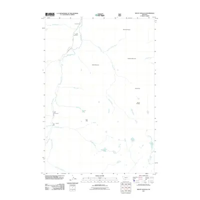
2011 Map of Mount Douglas
USGS Topo · Published 2011About this map
The Boulder River drainage defines this high-country landscape in Park County, Montana, carving a path through significant peaks and plateaus. Settlement is concentrated along the river corridor, where established sites like Camp Mimanagish and the Christikon camp reflect a long-standing use of the area for organized recreation and spiritual retreats. Near the confluence of Bridge Creek and Upsidedown Creek, the Lazy Day Ranch sits as a rare private landmark among the more numerous public-use sites such as the Hells Canyon Campground and Hicks Park Campground.
Find a feature on this map
28 named features on this map. Tap any name to fly to it.
Don’t see what you’re looking for? This feature index may not catch every label — zoom into the map to look around manually.
Map Details
Editions of this 2011 Mount Douglas Map
This is the sole edition of this map. No revisions or reprints were ever made.
Other maps of this area

1891 · Livingston
USGS Topo · 1:250,000

1893 · Livingston
USGS Topo · 1:250,000

1940 · Mt. Cowen
USGS Topo · 1:62,500

1940 · Mt Wallace
USGS Topo · 1:62,500

1941 · Mt Douglas
USGS Topo · 1:62,500

1942 · Cutoff Mtn
USGS Topo · 1:62,500

1943 · Mt Wallace
USGS Topo · 1:62,500

1943 · Mt Douglas
USGS Topo · 1:62,500

1943 · Mt Cowen
USGS Topo · 1:62,500

1944 · Cutoff Mtn
USGS Topo · 1:62,500