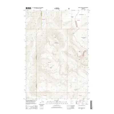
2014 Map of Mount Douglas
USGS Topo · Published 2014About this map
Mt Douglas and the high alpine terrain of the Beartooth Range dominate this 2014 survey, which spans the boundary of Park and Sweet Grass Counties. The landscape is a high-altitude wilderness divided between the Gallatin National Forest and Custer National Forest. The map reveals a complex network of glacial features, from the broad Breakneck Plateau and East Boulder Plateau to the sharp summits of Hawley Mtn and Snowy Peak. Water is a defining element of this high country, where the Boulder River and its F Fork drain a series of isolated basins containing Emerald Lake, Mirror Lake, and Trout Lake. The absence of roads or permanent settlements emphasizes the protected nature of this region, which remains a stronghold for pristine hydrology and high-peak topography.
Find a feature on this map
35 named features on this map. Tap any name to fly to it.
Don’t see what you’re looking for? This feature index may not catch every label — zoom into the map to look around manually.
Map Details
Editions of this 2014 Mount Douglas Map
This is the sole edition of this map. No revisions or reprints were ever made.
Other maps of this area

1891 · Livingston
USGS Topo · 1:250,000

1893 · Livingston
USGS Topo · 1:250,000

1940 · Mt. Cowen
USGS Topo · 1:62,500

1940 · Mt Wallace
USGS Topo · 1:62,500

1941 · Mt Douglas
USGS Topo · 1:62,500

1942 · Cutoff Mtn
USGS Topo · 1:62,500

1943 · Mt Wallace
USGS Topo · 1:62,500

1943 · Mt Douglas
USGS Topo · 1:62,500

1943 · Mt Cowen
USGS Topo · 1:62,500

1944 · Cutoff Mtn
USGS Topo · 1:62,500