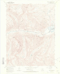
1967 Map of Mount Elbert
USGS Topo · Published 1972About this map
Mount Elbert, the highest peak in the Rockies, dominates this high-altitude survey of the San Isabel National Forest. The landscape is a complex network of glacial basins and steep ridges, including the La Plata Basin and the sharp Ellingwood Ridge. This era of the late 1960s shows the region in a state of transition; while recreational sites like Parry Peak Campground and Twin Peaks Campground are established, the terrain remains deeply marked by an earlier mining boom.
Find a feature on this map
55 named features on this map. Tap any name to fly to it.
Don’t see what you’re looking for? This feature index may not catch every label — zoom into the map to look around manually.
Map Details
Editions of this 1967 Mount Elbert Map
4 editions found
Other maps of this area

1889 · Leadville
USGS Topo · 1:125,000

1891 · Leadville
USGS Topo · 1:125,000

1909 · Mount Jackson
USGS Topo · 1:125,000

1911 · Mount Jackson
USGS Topo · 1:125,000

1934 · Taylor Park
USGS Topo · 1:62,500

1935 · Mount Elbert
USGS Topo · 1:62,500

1937 · Taylor Park
USGS Topo · 1:62,500

1938 · Mount Elbert
USGS Topo · 1:62,500

1939 · Mount Elbert
USGS Topo · 1:62,500

1942 · Leadville
USGS Topo · 1:125,000