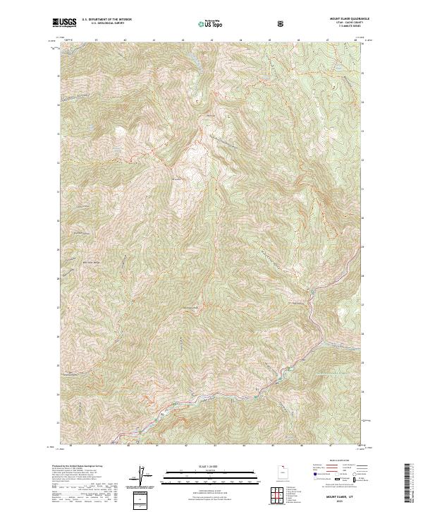
2023 Map of Mount Elmer
USGS Topo · Published 2023About this map
The Bear River Range dominates this portion of northern Utah, showcasing the primitive landscape protected within the Mount Naomi Wilderness and the Cache National Forest. High peaks including Mt Elmer, Mt Jardine, and Beirdneau Peak provide a dramatic vertical contrast to the deep drainage of the Logan River and its accompanying Logan Canyon. The map reveals an intricate network of specialized footpaths, such as the Mt Naomi Peak National Recreation Trl and the Riverside Nature Trl, which navigate the steep geography of Smithfield Canyon and Dry Canyon. This modern survey illustrates the enduring character of the high-elevation backcountry, where water features like Hansen Pond and Cottonwood Springs remain vital landmarks in a territory defined by limestone canyons and rugged summits.
Find a feature on this map
52 named features on this map. Tap any name to fly to it.
Don’t see what you’re looking for? This feature index may not catch every label — zoom into the map to look around manually.
Map Details
Editions of this 2023 Mount Elmer Map
This is the sole edition of this map. No revisions or reprints were ever made.
Other maps of this area

1914 · Logan
USGS Topo · 1:125,000

1916 · Logan
USGS Topo · 1:125,000

1949 · Boulter Mts
USGS Topo · 1:24,000

1954 · Ogden
USGS Topo · 1:250,000

1958 · Ogden
USGS Topo · 1:250,000

1960 · Ogden
USGS Topo · 1:250,000

1961 · Logan
USGS Topo · 1:24,000
1964 · Smithfield
USGS Topo · 1:24,000
1964 · Richmond
USGS Topo · 1:24,000
1969 · Tony Grove Creek
USGS Topo · 1:24,000
Featured Places
- Beirdneau Summer Home Area, UT
- Pine Bluffs Summer Home Area, UT
- Chokecherry Summer Home Area, UT
- Cache County, UT
- United States