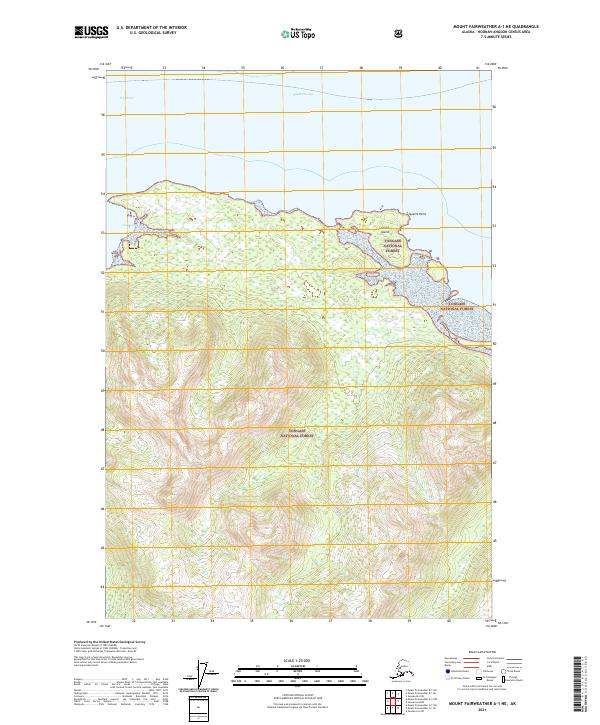
2021 Map of Mount Fairweather A-1 NE
USGS Topo · Published 2021About this map
Tongass National Forest dominates the land in this coastal region of the Alaska Panhandle, illustrating a landscape defined by dramatic elevation changes and marine passages. The northern edge of the sheet focuses on the meeting of land and sea where the South Passage and Icy Strait converge near Quartz Point. These waterways serve as significant maritime corridors, with Gull Cove providing a protected indentation along the rugged coastline. The map details the intricate contours of the coastal mountains, showing the dense network of drainage and elevation that characterizes this portion of the Hoonah-Angoon Census Area. Isolated features like Goose Island emphasize the complex archipelago nature of the shoreline, where the national forest boundary encompasses both the shoreline and the rising interior peaks.
Find a feature on this map
9 named features on this map. Tap any name to fly to it.
Don’t see what you’re looking for? This feature index may not catch every label — zoom into the map to look around manually.
Map Details
Editions of this 2021 Mount Fairweather A-1 NE Map
This is the sole edition of this map. No revisions or reprints were ever made.
Other maps of this area

1948 · Juneau B-6
USGS Topo · 1:63,360

1948 · Mount Fairweather B-1
USGS Topo · 1:63,360

1948 · Mount Fairweather A-1
USGS Topo · 1:63,360

1951 · Juneau
USGS Topo · 1:250,000

1951 · Juneau A-6
USGS Topo · 1:63,360

1951 · Mt Fairweather
USGS Topo · 1:250,000

1954 · Mount Fairweather A-1
USGS Topo · 1:63,360

1961 · Mt Fairweather
USGS Topo · 1:250,000

1962 · Juneau
USGS Topo · 1:250,000
2000 · Juneau A-6
USGS Topo · 1:63,360