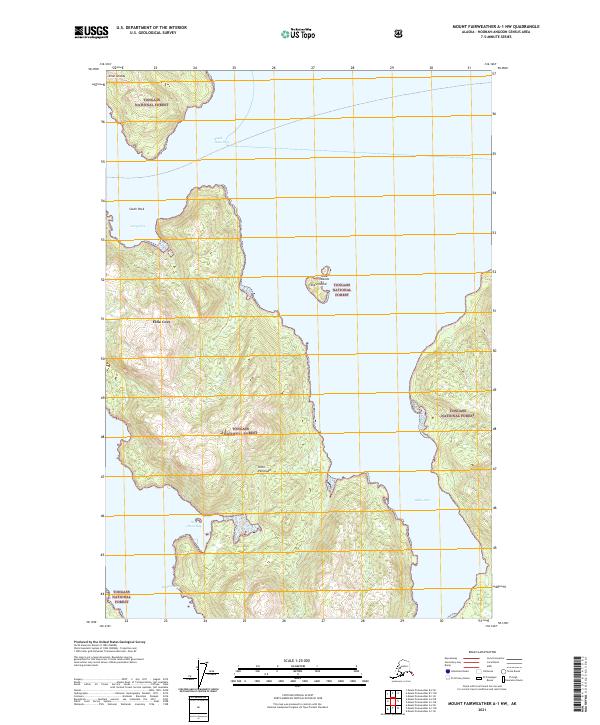
2021 Map of Mount Fairweather A-1 NW
USGS Topo · Published 2021About this map
Elfin Cove stands as the primary human footprint in this maritime landscape within the Tongass National Forest. Located on the northern end of Chichagof Island, this remote fishing community is defined by its protected harbor and reliance on the surrounding waterways. The map illustrates a complex network of coastal features including the Inian Peninsula and the nearby Inian Islands, separated by the treacherous waters of South Inian Pass.
Find a feature on this map
16 named features on this map. Tap any name to fly to it.
Don’t see what you’re looking for? This feature index may not catch every label — zoom into the map to look around manually.
Map Details
Editions of this 2021 Mount Fairweather A-1 NW Map
This is the sole edition of this map. No revisions or reprints were ever made.
Other maps of this area

1948 · Mount Fairweather A-2
USGS Topo · 1:63,360

1948 · Mount Fairweather B-1
USGS Topo · 1:63,360

1948 · Mount Fairweather B-2
USGS Topo · 1:63,360

1948 · Mount Fairweather A-1
USGS Topo · 1:63,360

1951 · Mt Fairweather
USGS Topo · 1:250,000

1954 · Mount Fairweather A-1
USGS Topo · 1:63,360

1961 · Mt Fairweather
USGS Topo · 1:250,000
2017 · Mount Fairweather B-1 SW
USGS Topo · 1:25,000
2017 · Mount Fairweather B-1 SE
USGS Topo · 1:25,000
2017 · Mount Fairweather A-1 SE
USGS Topo · 1:25,000