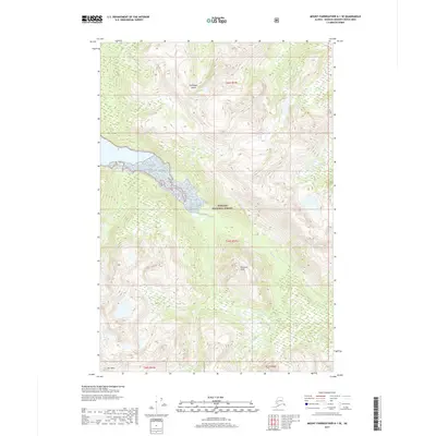
2017 Map of Mount Fairweather A-1 SE
USGS Topo · Published 2017About this map
Chichagof Island serves as the focal point for this 2017 survey, where the intricate topography of the Tongass National Forest is mapped in sharp detail. The landscape is defined by high alpine features like Pyramid Peak and Tarn Mtn, which overlook a network of glacial and river drainage systems. Waterways such as the Mud Bay River, Trail River, and Marble Cr flow through the valleys, illustrating the complex hydrological patterns of the Alaskan panhandle. This map highlights the intersection of public forest lands and unorganized borough territory, providing a clear view of the wilderness before more recent environmental changes. The contour intervals trace the steep ascent from riverbeds to summits, offering a precise look at the terrain that has shaped local navigation and land use in this part of Southeast Alaska.
Find a feature on this map
11 named features on this map. Tap any name to fly to it.
Don’t see what you’re looking for? This feature index may not catch every label — zoom into the map to look around manually.
Map Details
Editions of this 2017 Mount Fairweather A-1 SE Map
This is the sole edition of this map. No revisions or reprints were ever made.
Other maps of this area

1948 · Sitka D-6
USGS Topo · 1:63,360

1948 · Mount Fairweather A-1
USGS Topo · 1:63,360

1951 · Juneau
USGS Topo · 1:250,000

1951 · Juneau A-6
USGS Topo · 1:63,360

1951 · Sitka D-7
USGS Topo · 1:63,360

1951 · Mt Fairweather
USGS Topo · 1:250,000

1951 · Sitka
USGS Topo · 1:250,000

1951 · Sitka D-6
USGS Topo · 1:63,360

1952 · Sitka
USGS Topo · 1:250,000

1954 · Mount Fairweather A-1
USGS Topo · 1:63,360