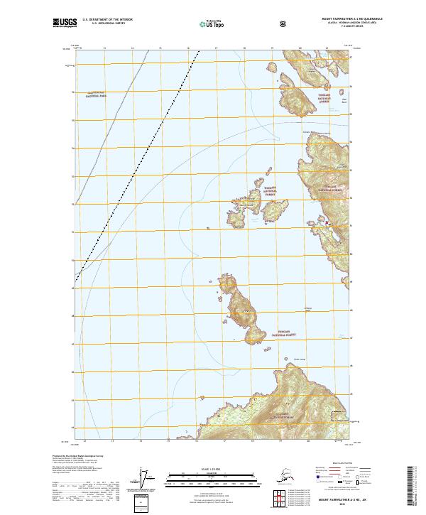
2021 Map of Mount Fairweather A-2 NE
USGS Topo · Published 2021About this map
Elfin Cove stands as the primary human settlement in this maritime landscape where the waters of South Inian Pass and Mosquito Pass thread through a complex archipelago. The terrain is defined by the Inian Islands and the Inian Peninsula, situated at the convergence of Glacier Bay National Park and Tongass National Forest. This 2021 survey illustrates a region where maritime navigation is essential, highlighting small-boat havens like Granite Cove on the George Islands and the curiously named The Hobbit Hole to the north. Further south, the coastlines of Three Hill Island and the approach to Port Althorp reveal a coastline shaped by numerous rocks and points, including Althorp Rock and Point Lucan, illustrating the intricate geography of the Hoonah-Angoon Census Area.
Find a feature on this map
23 named features on this map. Tap any name to fly to it.
Don’t see what you’re looking for? This feature index may not catch every label — zoom into the map to look around manually.
Map Details
Editions of this 2021 Mount Fairweather A-2 NE Map
This is the sole edition of this map. No revisions or reprints were ever made.
Other maps of this area

1948 · Mount Fairweather A-2
USGS Topo · 1:63,360

1948 · Mount Fairweather B-1
USGS Topo · 1:63,360

1948 · Mount Fairweather B-2
USGS Topo · 1:63,360

1948 · Mount Fairweather A-1
USGS Topo · 1:63,360

1951 · Mt Fairweather
USGS Topo · 1:250,000

1954 · Mount Fairweather A-1
USGS Topo · 1:63,360

1961 · Mt Fairweather
USGS Topo · 1:250,000
2017 · Mount Fairweather B-1 SW
USGS Topo · 1:25,000
2017 · Mount Fairweather A-2 NW
USGS Topo · 1:25,000
2017 · Mount Fairweather A-1 SW
USGS Topo · 1:25,000