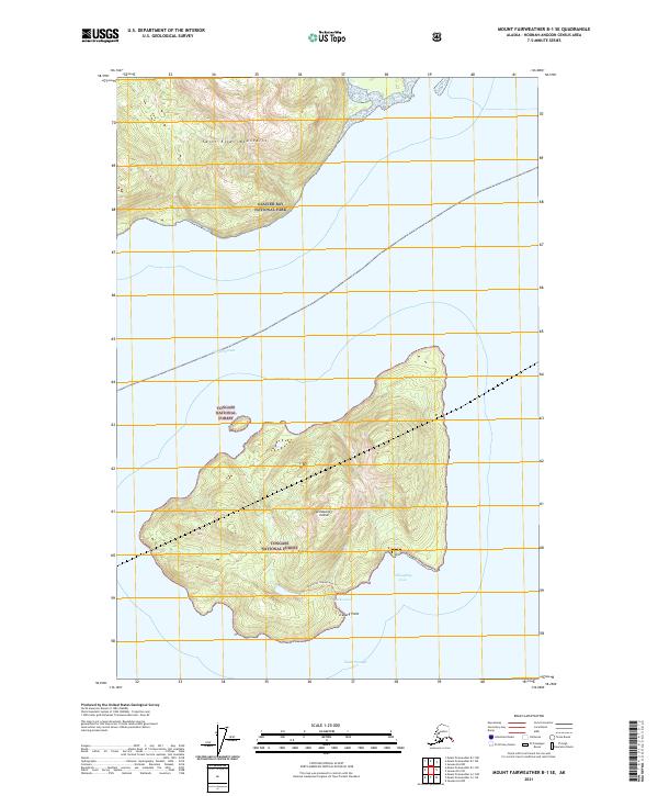
2021 Map of Mount Fairweather B-1 SE
USGS Topo · Published 2021About this map
Lemesurier Island dominates the center of this maritime landscape, situated within the expansive reach of the Tongass National Forest. The island is defined by its dramatic relief, rising from the waters of North Passage and South Passage toward a central peak. To the north, the terrain transitions into the rugged foothills of the Saint Elias Mountains within the southern reaches of Glacier Bay National Park. The map reveals a remote environment where land and water are tightly integrated, featuring the sheltered Jacks Cove and Willoughby Cove along the island's coastline. High-altitude water features like Lemesurier Island Lake Tri suggest a steep and complex hydrology, while Iceberg Point serves as a prominent navigational marker for the surrounding icy waterways.
Find a feature on this map
16 named features on this map. Tap any name to fly to it.
Don’t see what you’re looking for? This feature index may not catch every label — zoom into the map to look around manually.
Map Details
Editions of this 2021 Mount Fairweather B-1 SE Map
This is the sole edition of this map. No revisions or reprints were ever made.
Other maps of this area

1948 · Juneau B-6
USGS Topo · 1:63,360

1948 · Mount Fairweather B-1
USGS Topo · 1:63,360

1948 · Mount Fairweather A-1
USGS Topo · 1:63,360

1951 · Juneau
USGS Topo · 1:250,000

1951 · Juneau A-6
USGS Topo · 1:63,360

1951 · Mt Fairweather
USGS Topo · 1:250,000

1954 · Mount Fairweather A-1
USGS Topo · 1:63,360

1961 · Mt Fairweather
USGS Topo · 1:250,000

1962 · Juneau
USGS Topo · 1:250,000
2000 · Juneau A-6
USGS Topo · 1:63,360