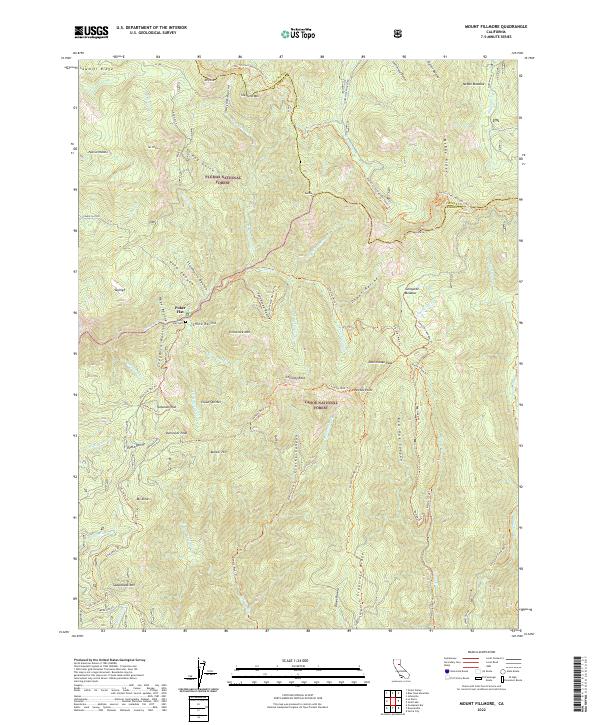
2022 Map of Mount Fillmore
USGS Topo · Published 2022About this map
Mt Fillmore rises as a central landmark in this high-elevation landscape at the border of Plumas National Forest and Tahoe National Forest. The map documents a rugged interior of the Sierra Nevada where history and recreation intersect, notably through the Pacific Crest National Scenic Trl winding across McRae Ridge and past Mt Etna. Settlements such as Skyhigh and Tamarack Flat are located near steep drainage systems like Studhorse Ravine and Gold Canyon. For genealogists and local historians, the inclusion of Poker Flat and the Poker Flat Cem provides a tangible link to the era of remote mountain habitation and mining. The terrain is deeply incised by the Downie River and its various branches, including the W Br Downie River, and crisscrossed by specialized routes like the Gibraltar Mine Trl and Red Oak Ohv Trl.
Find a feature on this map
83 named features on this map. Tap any name to fly to it.
Don’t see what you’re looking for? This feature index may not catch every label — zoom into the map to look around manually.
Map Details
Editions of this 2022 Mount Fillmore Map
This is the sole edition of this map. No revisions or reprints were ever made.
Other maps of this area

1891 · Downieville
USGS Topo · 1:125,000

1893 · Downieville
USGS Topo · 1:125,000

1895 · Downieville
USGS Topo · 1:125,000

1896 · Downieville
USGS Topo · 1:125,000

1897 · Downieville
USGS Topo · 1:125,000

1937 · Blairsden
USGS Topo · 1:48,000

1943 · Blairsden
USGS Topo · 1:62,500
1950 · Onion Valley
USGS Topo · 1:24,000
1951 · Onion Valley
USGS Topo · 1:24,000
1951 · Mt. Fillmore
USGS Topo · 1:24,000