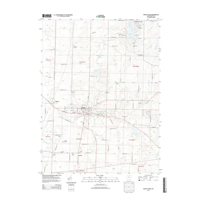
2013 Map of Mount Gilead
USGS Topo · Published 2013About this map
Mount Gilead serves as the central hub of this Morrow County landscape, where the street grid of the village meets the rural sections of Gilead Township. The area is defined by a dense network of local cemeteries that offer significant value for genealogical research, including the Mt Tabor Methodist Episcopal Cem, Friends Cem, and County Home Cem. To the east of the village, Mount Gilead State Park encompasses Mount Gilead Upper Lake, while the private community at Candlewood Lake creates a distinct residential pattern in the northeast. The geography is further shaped by the winding paths of Whetstone Creek and the Kokosing River. Industrial and infrastructure markers such as the Morrow County Airport and the village of Edison highlight the connectivity of this central Ohio region in the early twenty-first century.
Find a feature on this map
143 named features on this map. Tap any name to fly to it.
Don’t see what you’re looking for? This feature index may not catch every label — zoom into the map to look around manually.
Map Details
Editions of this 2013 Mount Gilead Map
This is the sole edition of this map. No revisions or reprints were ever made.
Other maps of this area

1913 · Mount Gilead
USGS Topo · 1:62,500

1915 · Shauck
USGS Topo · 1:62,500

1915 · Marengo
USGS Topo · 1:62,500

1915 · Fredericktown
USGS Topo · 1:62,500

1916 · Mount Gilead
USGS Topo · 1:62,500

1943 · Shauck
USGS Topo · 1:62,500

1943 · Marengo
USGS Topo · 1:62,500

1943 · Mount Gilead
USGS Topo · 1:62,500

1943 · Fredericktown
USGS Topo · 1:62,500

1950 · Marion
USGS Topo · 1:250,000