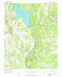
1956 Map of Mount Gilead West
USGS Topo · Published 1957About this map
The Lake Pee Dee Tillery River dominates this mid-century landscape, a major reservoir created by the Norwood Dam and powered by the adjacent Hydroelectric Plant. The map illustrates the complex intersection of four counties—Stanly, Montgomery, Anson, and Richmond—along the water's course. Development is centered around the towns of Mount Gilead and Norwood, which are linked by the Norfolk Southern railroad.
Find a feature on this map
49 named features on this map. Tap any name to fly to it.
Don’t see what you’re looking for? This feature index may not catch every label — zoom into the map to look around manually.
Map Details
Editions of this 1956 Mount Gilead West Map
3 editions found
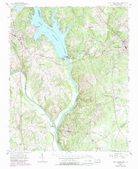
Other maps of this area

1942 · Troy
USGS Topo · 1:125,000

1953 · Raleigh
USGS Topo · 1:250,000

1953 · Charlotte
USGS Topo · 1:250,000

1954 · Charlotte
USGS Topo · 1:250,000

1954 · Raleigh
USGS Topo · 1:250,000

1956 · Mangum
USGS Topo · 1:24,000

1956 · Mount Gilead East
USGS Topo · 1:24,000

1956 · Ansonville
USGS Topo · 1:24,000

1956 · Mount Gilead West
USGS Topo · 1:24,000

1957 · Albemarle
USGS Topo · 1:62,500