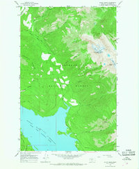
1964 Map of Mount Grant
USGS Topo · Published 1968About this map
Hungry Horse Reservoir dominates the southern reaches of this landscape, its waters filling the canyon of the South Fork Flathead River following the mid-century completion of the dam downstream. The topography rises sharply toward the northeast, where the high peaks of the Flathead National Forest harbor the Stanton Glacier and Grant Glacier. These ice bodies cling to the slopes of Great Northern Mountain and Mount Grant, marking the dramatic elevation shift from the reservoir floor to the alpine summits.
Find a feature on this map
32 named features on this map. Tap any name to fly to it.
Don’t see what you’re looking for? This feature index may not catch every label — zoom into the map to look around manually.
Map Details
Editions of this 1964 Mount Grant Map
2 editions found
Other maps of this area

1914 · Nyack
USGS Topo · 1:125,000

1958 · Felix Peak
USGS Topo · 1:24,000

1960 · Cut Bank
USGS Topo · 1:250,000

1963 · Cut Bank
USGS Topo · 1:250,000

1964 · Cut Bank
USGS Topo · 1:250,000
1964 · Jewel Basin
USGS Topo · 1:24,000

1964 · Nyack
USGS Topo · 1:24,000

1964 · Pinnacle
USGS Topo · 1:24,000

1964 · Stanton Lake
USGS Topo · 1:24,000
1964 · Nyack SW
USGS Topo · 1:24,000