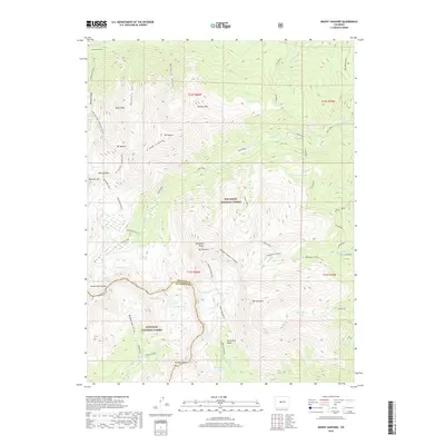
2019 Map of Mount Harvard
USGS Topo · Published 2019About this map
The high alpine crest of the Collegiate Peaks dominates this 2019 survey, where the peaks of Mt Harvard, Mt Columbia, Mt Belford, and Mt Oxford tower over the surrounding basins. This landscape is defined by the sharp boundary of the Continental Divide, which separates the San Isabel National Forest in Chaffee County from the Gunnison National Forest to the west. Evidence of the region's human history is preserved at the Winfield Cem near the northern edge, while the high country is marked by technical routes such as the Harvard Columbia Scramble and the Elkhead Pass. Numerous glacial lakes and high basins, including Lake Rebecca, Bear Lake, and the Horn Fork Basin, feed the complex drainage network of Pine Creek and Missouri Gulch, illustrating the classic high-altitude hydrology of the Sawatch Range.
Find a feature on this map
50 named features on this map. Tap any name to fly to it.
Don’t see what you’re looking for? This feature index may not catch every label — zoom into the map to look around manually.
Map Details
Editions of this 2019 Mount Harvard Map
This is the sole edition of this map. No revisions or reprints were ever made.
Other maps of this area

1889 · Leadville
USGS Topo · 1:125,000

1891 · Leadville
USGS Topo · 1:125,000

1935 · Mount Elbert
USGS Topo · 1:62,500

1938 · Mount Elbert
USGS Topo · 1:62,500

1939 · Mount Elbert
USGS Topo · 1:62,500

1942 · Leadville
USGS Topo · 1:125,000

1955 · Buena Vista
USGS Topo · 1:62,500

1955 · Mount Harvard
USGS Topo · 1:62,500

1956 · Montrose
USGS Topo · 1:250,000

1957 · Leadville
USGS Topo · 1:250,000