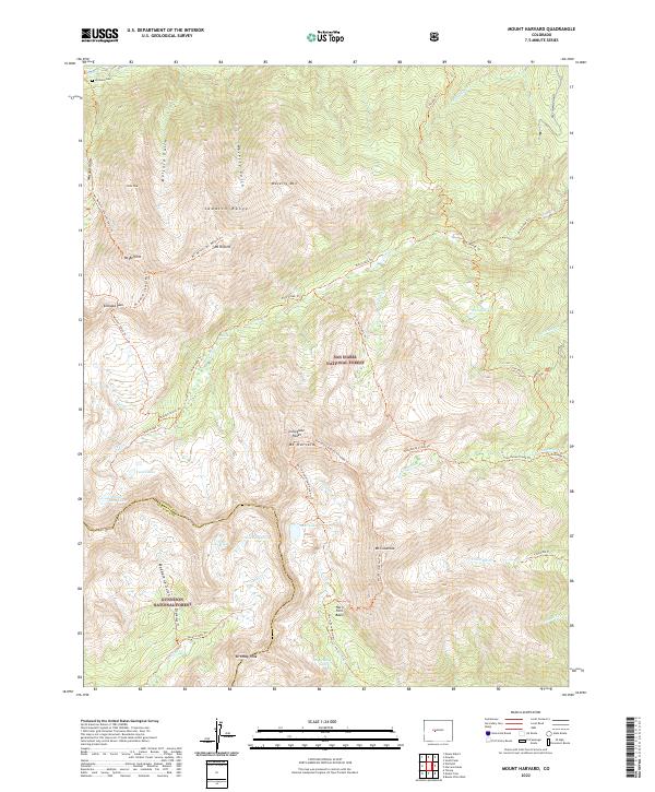
2022 Map of Mount Harvard
USGS Topo · Published 2022About this map
The Collegiate Peaks dominate this section of the Sawatch Range, featuring some of Colorado's highest summits including Mt Harvard and Mt Columbia. This high-altitude landscape is defined by the steep glacial cirques of the Horn Fork Basin and the alpine waters of Twin Lakes and Silver King Lake. The presence of the Winfield Cem in the northwest corner near Clear Cr offers a tangible connection to early mountain settlement and mining history.
Find a feature on this map
56 named features on this map. Tap any name to fly to it.
Don’t see what you’re looking for? This feature index may not catch every label — zoom into the map to look around manually.
Map Details
Editions of this 2022 Mount Harvard Map
This is the sole edition of this map. No revisions or reprints were ever made.
Other maps of this area

1889 · Leadville
USGS Topo · 1:125,000

1891 · Leadville
USGS Topo · 1:125,000

1935 · Mount Elbert
USGS Topo · 1:62,500

1938 · Mount Elbert
USGS Topo · 1:62,500

1939 · Mount Elbert
USGS Topo · 1:62,500

1942 · Leadville
USGS Topo · 1:125,000

1955 · Buena Vista
USGS Topo · 1:62,500

1955 · Mount Harvard
USGS Topo · 1:62,500

1956 · Montrose
USGS Topo · 1:250,000

1957 · Leadville
USGS Topo · 1:250,000