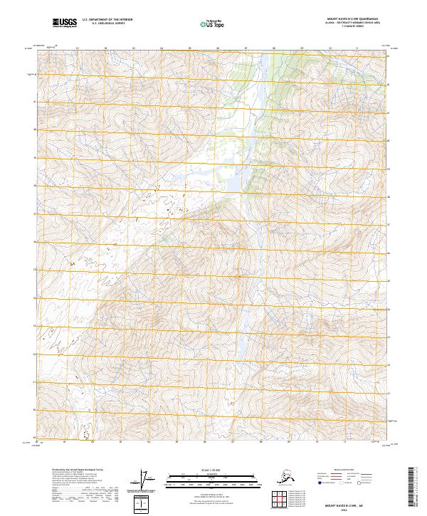
2024 Map of Mount Hayes B-2 NW
USGS Topo · Published 2024About this map
Johnson River carves a deep valley through this high-elevation portion of the Alaska Range. The landscape is dominated by extreme vertical relief and glacial drainage patterns, where Elting Creek flows through the northern reaches of the quadrangle. This 2024 edition provides a modern topographic record of this interior Alaskan wilderness, illustrating the complex hydrology and natural contours of a region primarily defined by its physical geography rather than human settlement. The map serves as a vital reference for understanding the geological structure and waterway networks of the eastern range, showcasing the expansive, undeveloped terrain managed through the Public Land Survey System.
Find a feature on this map
11 named features on this map. Tap any name to fly to it.
Don’t see what you’re looking for? This feature index may not catch every label — zoom into the map to look around manually.
Map Details
Editions of this 2024 Mount Hayes B-2 NW Map
This is the sole edition of this map. No revisions or reprints were ever made.
Other maps of this area

1950 · Mount Hayes
USGS Topo · 1:250,000

1951 · Mount Hayes
USGS Topo · 1:250,000

1954 · Mount Hayes C-3
USGS Topo · 1:63,360

1955 · Mount Hayes B-3
USGS Topo · 1:63,360

1955 · Mount Hayes C-2
USGS Topo · 1:63,360

1955 · Mount Hayes B-2
USGS Topo · 1:63,360

1955 · Mount Hayes C-3
USGS Topo · 1:63,360

1955 · Mount Hayes
USGS Topo · 1:250,000
2016 · Mount Hayes B-3 NE
USGS Topo · 1:25,000
2016 · Mount Hayes B-2 SE
USGS Topo · 1:25,000