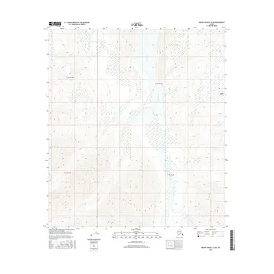
2016 Map of Mount Hayes C-2 SW
USGS Topo · Published 2016About this map
The Alaska Range dominates this landscape in the Unorganized Borough, where extreme topographic relief defines the drainage patterns of the eastern interior. The massive glacial valley of the Johnson River serves as the central geographic corridor, cutting a wide path through the high peaks. This braided river system is fed by high-altitude tributaries, including Pegmatite Cr in the northwest and Prospect Cr and Elting Creek in the southeast. The map reveals the stark transition between steep mountain slopes and the broad, sediment-rich floor of the river valley. The absence of roads or permanent settlements in this 2016 survey emphasizes the wilderness character of this region, where the terrain is governed entirely by the shifting waters and high-elevation contours of the Alaska Range.
Find a feature on this map
9 named features on this map. Tap any name to fly to it.
Don’t see what you’re looking for? This feature index may not catch every label — zoom into the map to look around manually.
Map Details
Editions of this 2016 Mount Hayes C-2 SW Map
This is the sole edition of this map. No revisions or reprints were ever made.
Other maps of this area

1950 · Mount Hayes
USGS Topo · 1:250,000

1951 · Mount Hayes
USGS Topo · 1:250,000

1954 · Mount Hayes C-3
USGS Topo · 1:63,360

1955 · Mount Hayes B-3
USGS Topo · 1:63,360

1955 · Mount Hayes C-2
USGS Topo · 1:63,360

1955 · Mount Hayes B-2
USGS Topo · 1:63,360

1955 · Mount Hayes C-3
USGS Topo · 1:63,360

1955 · Mount Hayes
USGS Topo · 1:250,000
2016 · Mount Hayes B-3 NE
USGS Topo · 1:25,000
2016 · Mount Hayes B-2 NW
USGS Topo · 1:25,000