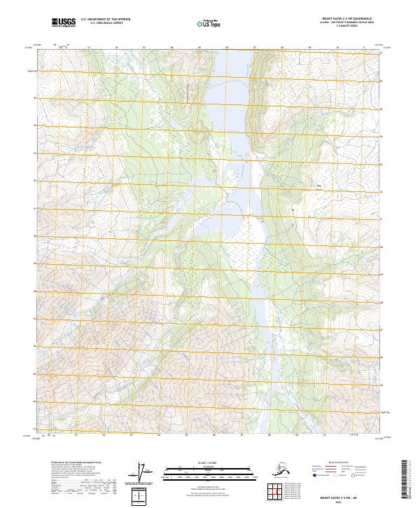
2024 Map of Mount Hayes C-2 SW
USGS Topo · Published 2024About this map
Independent Ridge stands as a prominent topographical spine between the drainages of the Johnson River and Pegmatite Creek in this northern Alaskan interior landscape. The river system dominates the central corridor, characterized by wide braided channels and extensive wetland areas typical of the glacial outwash plains in the Southeast Fairbanks region. This 2024 survey captures the untouched hydrology of several major tributaries, including Prospect Creek, Elting Creek, and Dry Creek, which feed into the main river valley from the surrounding high-elevation terrain. The absence of roads or permanent structures reflects the wilderness character of the Alaska Range foothills, where the primary landmarks are established by natural drainage patterns and the massive landforms defined by the U.S. Public Land Survey System grids, such as t15s r14e and t16s r15e.
Find a feature on this map
10 named features on this map. Tap any name to fly to it.
Don’t see what you’re looking for? This feature index may not catch every label — zoom into the map to look around manually.
Map Details
Editions of this 2024 Mount Hayes C-2 SW Map
This is the sole edition of this map. No revisions or reprints were ever made.
Other maps of this area

1950 · Mount Hayes
USGS Topo · 1:250,000

1951 · Mount Hayes
USGS Topo · 1:250,000

1954 · Mount Hayes C-3
USGS Topo · 1:63,360

1955 · Mount Hayes B-3
USGS Topo · 1:63,360

1955 · Mount Hayes C-2
USGS Topo · 1:63,360

1955 · Mount Hayes B-2
USGS Topo · 1:63,360

1955 · Mount Hayes C-3
USGS Topo · 1:63,360

1955 · Mount Hayes
USGS Topo · 1:250,000
2016 · Mount Hayes B-3 NE
USGS Topo · 1:25,000
2016 · Mount Hayes B-2 NW
USGS Topo · 1:25,000