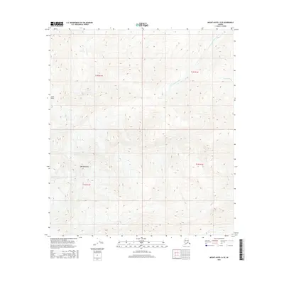
2016 Map of Mount Hayes C-3 SE
USGS Topo · Published 2016About this map
Mt Hajdukovich stands as the prominent peak within this section of the Alaska Range, situated in the southeastern corner of the Mount Hayes C-3 quadrangle. The landscape is defined by high elevations and the glacial drainage patterns typical of this interior Alaskan territory. The Little Gerstle River flows through the northeastern reaches of the map, fed by smaller tributaries such as Sheep Cr and Pegmatite Cr. This 2016 survey illustrates a largely untouched mountain environment where land is divided primarily by township and range lines, including t16s r14e and t15s r13e. The absence of developed roads or named settlements reflects the wilderness character of the region, making this a vital resource for understanding the topography and natural hydrology of the eastern Alaska Range.
Find a feature on this map
9 named features on this map. Tap any name to fly to it.
Don’t see what you’re looking for? This feature index may not catch every label — zoom into the map to look around manually.
Map Details
Editions of this 2016 Mount Hayes C-3 SE Map
This is the sole edition of this map. No revisions or reprints were ever made.
Other maps of this area

1950 · Mount Hayes
USGS Topo · 1:250,000

1951 · Mount Hayes
USGS Topo · 1:250,000

1954 · Mount Hayes C-3
USGS Topo · 1:63,360

1955 · Mount Hayes B-3
USGS Topo · 1:63,360

1955 · Mount Hayes C-2
USGS Topo · 1:63,360

1955 · Mount Hayes B-2
USGS Topo · 1:63,360

1955 · Mount Hayes C-3
USGS Topo · 1:63,360

1955 · Mount Hayes
USGS Topo · 1:250,000
2016 · Mount Hayes B-3 NE
USGS Topo · 1:25,000
2016 · Mount Hayes B-2 NW
USGS Topo · 1:25,000