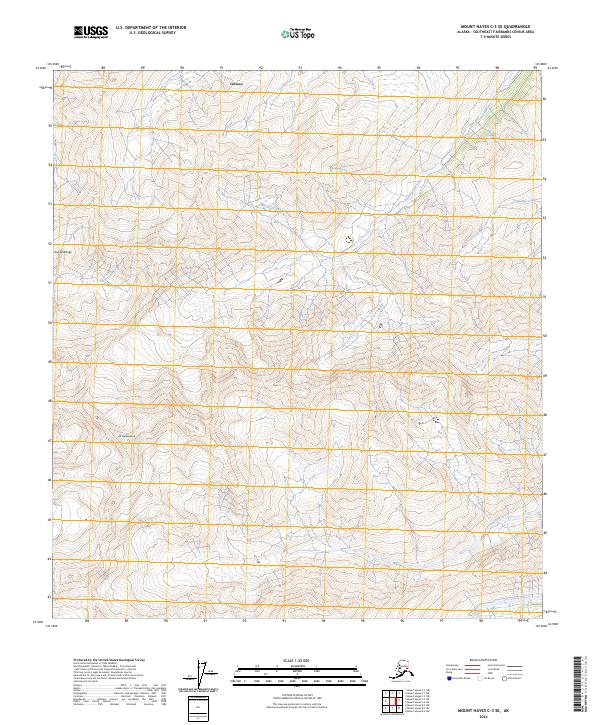
2024 Map of Mount Hayes C-3 SE
USGS Topo · Published 2024About this map
Mt Hajdukovich stands as a prominent landmark within this portion of the Alaska Range, where steep slopes transition into the drainages of the Southeast Fairbanks region. The landscape is defined by the high-altitude hydrology of the Little Gerstle River and its tributaries, including Sheep Creek and Pegmatite Creek. While much of the terrain remains undeveloped, the northern edge of the map includes the southern boundary of Deltana, reflecting the edge of human activity in an otherwise remote section of the interior. This 2024 survey detail is essential for understanding the natural contours and water systems of the Tanana Valley's southern reaches, providing precise data for the township and range system across t15s r13e and t16s r14e.
Find a feature on this map
10 named features on this map. Tap any name to fly to it.
Don’t see what you’re looking for? This feature index may not catch every label — zoom into the map to look around manually.
Map Details
Editions of this 2024 Mount Hayes C-3 SE Map
This is the sole edition of this map. No revisions or reprints were ever made.
Other maps of this area

1950 · Mount Hayes
USGS Topo · 1:250,000

1951 · Mount Hayes
USGS Topo · 1:250,000

1954 · Mount Hayes C-3
USGS Topo · 1:63,360

1955 · Mount Hayes B-3
USGS Topo · 1:63,360

1955 · Mount Hayes C-2
USGS Topo · 1:63,360

1955 · Mount Hayes B-2
USGS Topo · 1:63,360

1955 · Mount Hayes C-3
USGS Topo · 1:63,360

1955 · Mount Hayes
USGS Topo · 1:250,000
2016 · Mount Hayes B-3 NE
USGS Topo · 1:25,000
2016 · Mount Hayes B-2 NW
USGS Topo · 1:25,000