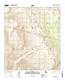
2016 Map of Mount Hayes C-5 NE
USGS Topo · Published 2016About this map
The Southeast Fairbanks interior of Alaska is defined here by the rigorous divisions of the Public Land Survey System, as documented in 2016. This specific quadrangle covers a landscape transition across several townships, including T13s R8e, T13s R9e, and T14s R8e. The map illustrates the topographic contours and hydrography of the region during the early twenty-first century, providing a high-resolution view of the terrain within T14s R9e and T15s R8e. While the area is largely devoid of named settlements or infrastructure, the intersection of boundaries such as T15s R9e allows for precise geographic study of this sub-arctic environment. The lack of cultural labels underscores the wilderness character of the Mount Hayes area, where elevation and water drainage patterns are the primary features of interest for researchers and explorers.
Find a feature on this map
6 named features on this map. Tap any name to fly to it.
Don’t see what you’re looking for? This feature index may not catch every label — zoom into the map to look around manually.
Map Details
Editions of this 2016 Mount Hayes C-5 NE Map
This is the sole edition of this map. No revisions or reprints were ever made.
Other maps of this area

1950 · Mount Hayes
USGS Topo · 1:250,000

1950 · Mount Hayes D-4
USGS Topo · 1:63,360

1950 · Mount Hayes C-4
USGS Topo · 1:63,360

1950 · Mount Hayes D-5
USGS Topo · 1:63,360

1951 · Mount Hayes
USGS Topo · 1:250,000

1951 · Mount Hayes C-5
USGS Topo · 1:63,360

1952 · Mount Hayes D-5
USGS Topo · 1:63,360

1952 · Mount Hayes D-4
USGS Topo · 1:63,360

1952 · Mount Hayes C-4
USGS Topo · 1:63,360

1955 · Mount Hayes
USGS Topo · 1:250,000