
1952 Map of Mount Hayes D-5
USGS Topo · Published 1952About this map
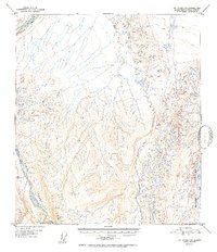
Delta River and Delta Creek dominate this 1952 topographic study within the Alaska-Fourth Judicial Division, revealing a landscape defined by braided river systems and glacial meltwater patterns. The survey, based on 1949 aerial photography, documents the complex hydrology of the region as these waters move toward the Tanana Valley. Small tributaries like Ptarmigan Creek are captured alongside a vast network of unnamed ponds and kettles, illustrating the periglacial geography of the northern foothills. For the geomorphologist or northern history researcher, this map provides a clear record of the river braided channels and drainage basins before mid-century shifts in the Alaskan interior. The lack of named settlements emphasizes the remote, wilderness character of this terrain during the early Cold War era, when such mapping efforts were essential for regional development and navigation.
Find a feature on this map
3 named features on this map. Tap any name to fly to it.
Don’t see what you’re looking for? This feature index may not catch every label — zoom into the map to look around manually.
Map Details
Editions of this 1952 Mount Hayes D-5 Map
2 editions found
Other maps of this area

1949 · Big Delta A-6
USGS Topo · 1:63,360

1950 · Mount Hayes
USGS Topo · 1:250,000

1950 · Big Delta
USGS Topo · 1:250,000

1950 · Big Delta A-5
USGS Topo · 1:63,360

1950 · Mount Hayes D-4
USGS Topo · 1:63,360

1950 · Mount Hayes C-4
USGS Topo · 1:63,360

1950 · Big Delta A-4
USGS Topo · 1:63,360

1950 · Mount Hayes D-6
USGS Topo · 1:63,360

1950 · Mount Hayes D-5
USGS Topo · 1:63,360

1951 · Big Delta
USGS Topo · 1:250,000